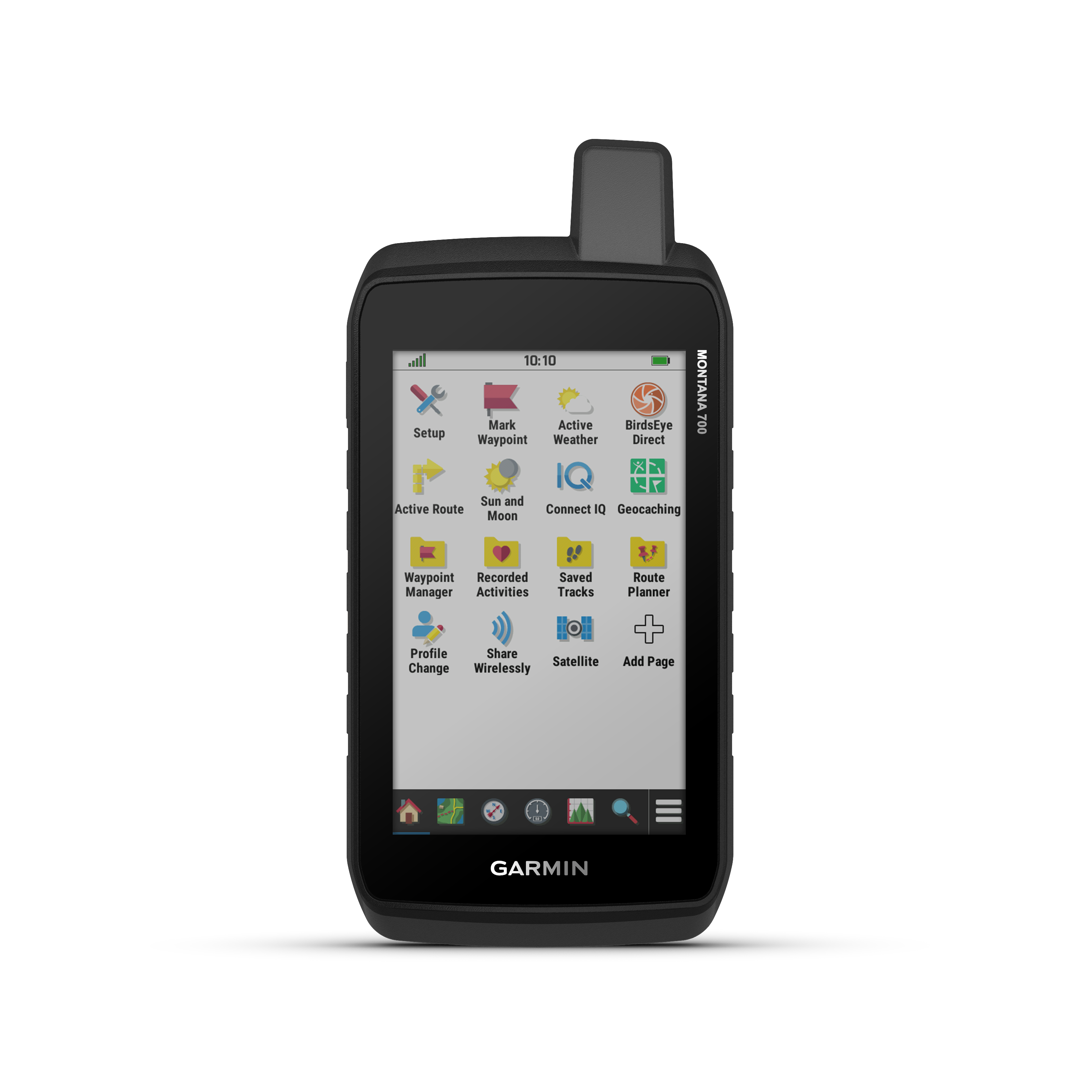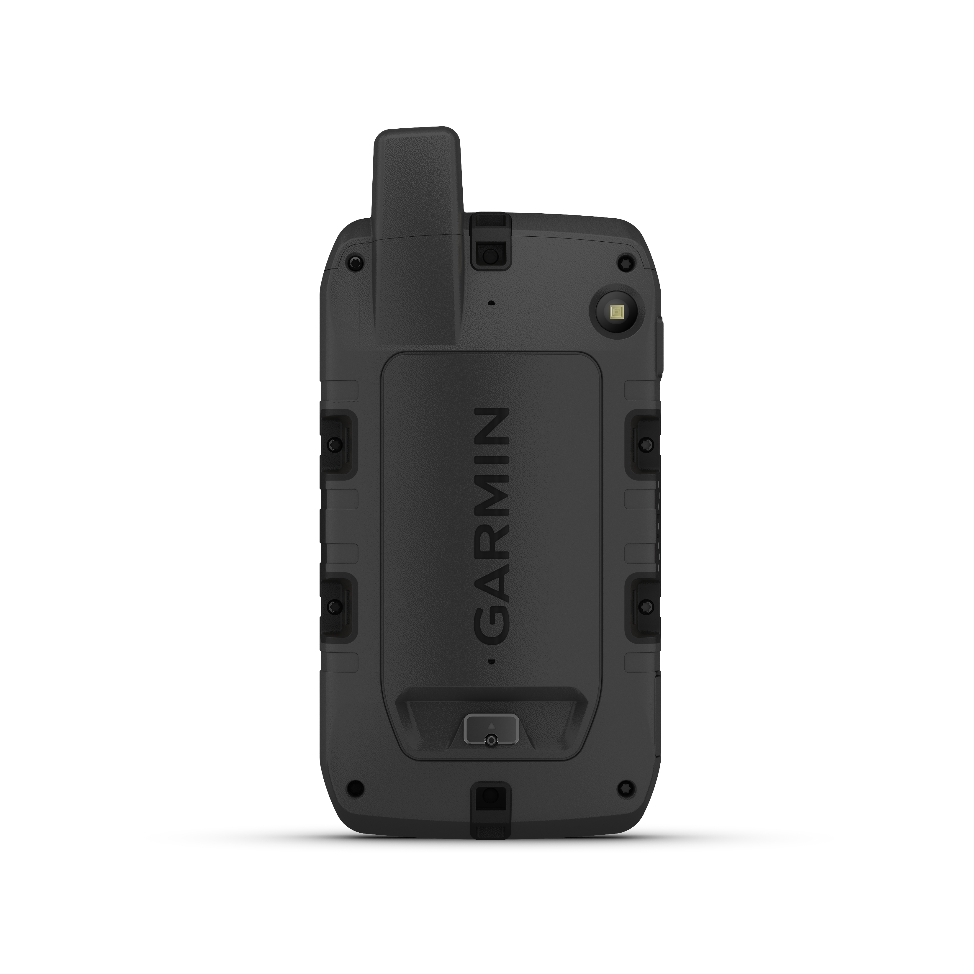
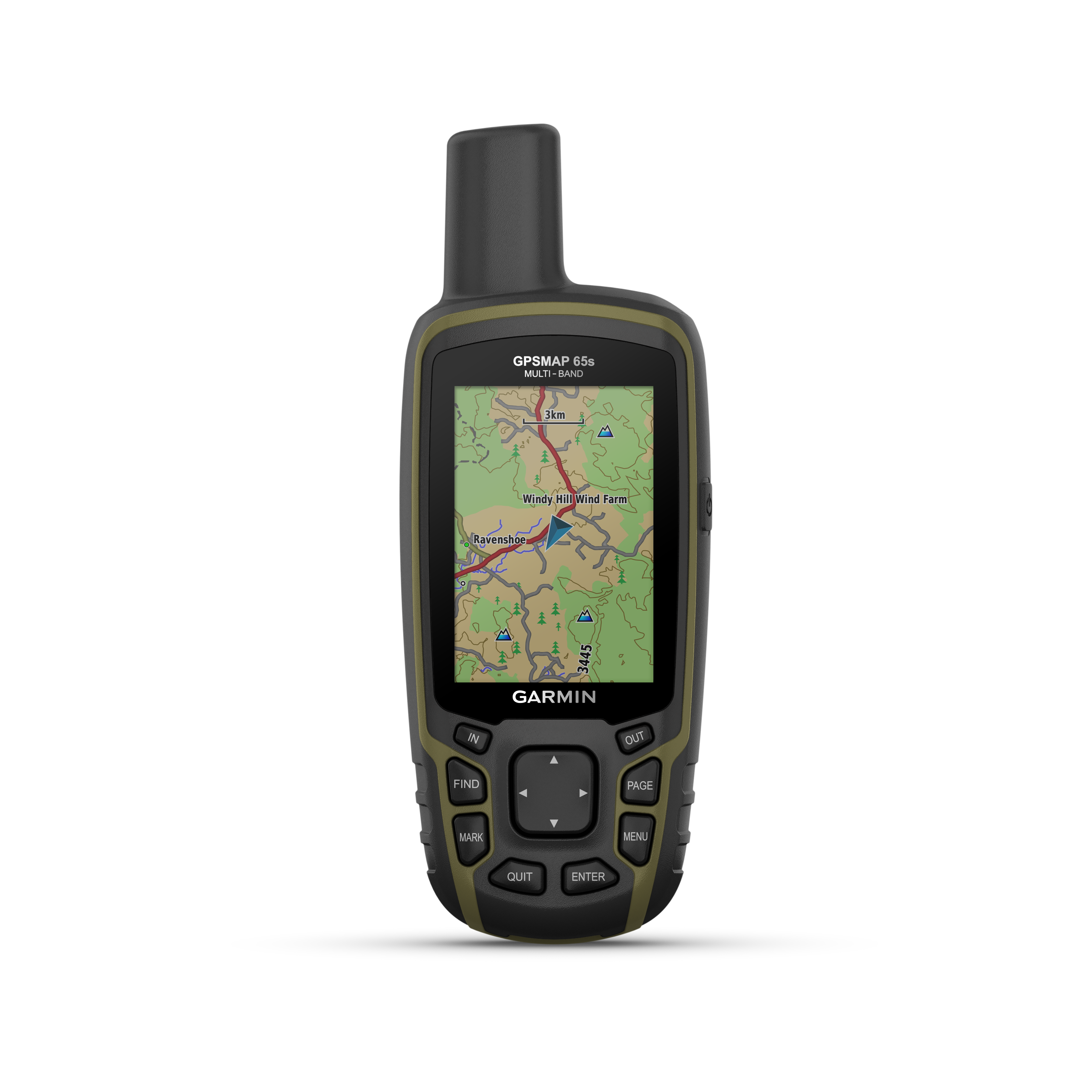
GARMIN GPSMAP 65S
$629.00
Description
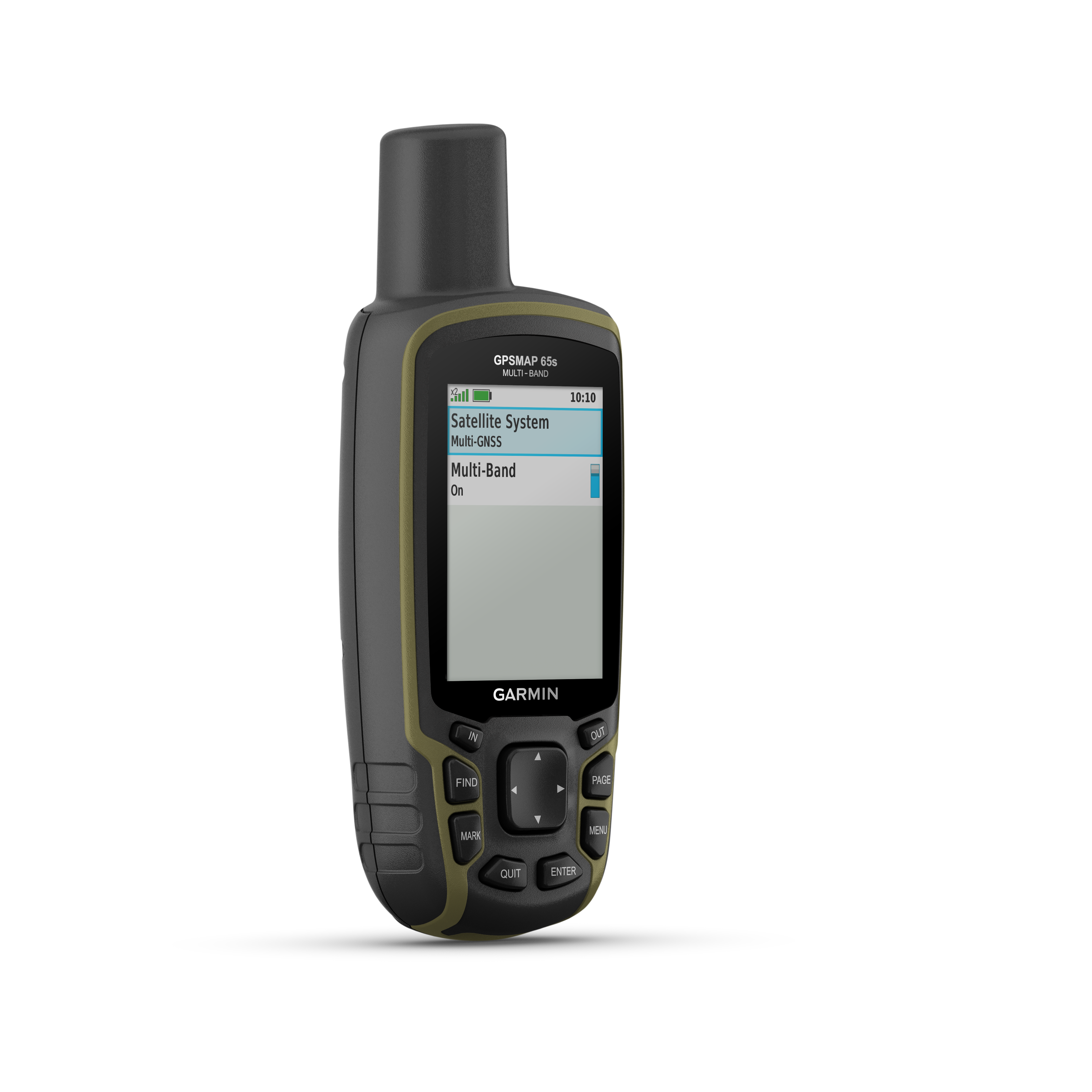
GPSMAP® 65s
FIND YOUR WAY IN THIS BIG, WIDE WORLD
Explore more with this rugged handheld that offers optimal tracking accuracy, a 2.6-inch colour display and preloaded maps.
Don’t miss a detail with this large, sunlight-readable colour display.
Lead the way in challenging locations with multi-band technology and expanded GNSS satellite support.
Cross the countryside with routable TopoActive maps.
Plot your next move with built-in navigation sensors.
Organise your adventure from anywhere with the Garmin Explore™ website and app1.
Travel with up to 16 hours of battery life in GPS mode.
EXPANDED GNSS SUPPORT
Multi-band technology and expanded GNSS support (GPS, GLONASS, Galileo, QZSS and IRNSS) provide optimal accuracy in steep country, urban canyons and forests with dense trees.
ABC SENSORS
Navigate every trail with ABC sensors, including an altimeter for elevation data, barometer to monitor weather and 3-axis electronic compass.
PRELOADED TOPOACTIVE AUSTRALIA AND NEW ZEALAND MAPS
Preloaded TopoActive maps provide detailed views of routable street and off-road networks, waterways, natural features, land use areas, buildings and more.
SMART NOTIFICATIONS
Receive emails, texts and alerts right on your handheld when paired with your compatible device.
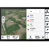
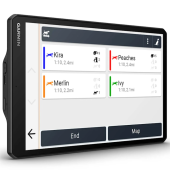
GARMIN EXPLORE APP
Plan, review and sync waypoints, routes and tracks by using the Garmin Explore app1 and website. You can even review completed activities while still in the field.
GEOCACHING
Get automatic cache updates from Geocaching Live, including descriptions, logs and hints.
MICROSD™ SLOT
Using your compatible device and microSD memory card, conveniently download TOPO 24K maps and hit the trail, or access HuntView Plus maps to see public land types and boundaries as well as private landowner names and boundaries.
Physical & Performance
| Display Size | 3.6 x 5.5 cm; 2.6-inch diagonal (6.6 cm) |
| Battery type | 2 AA batteries (not included); NiMH or Lithium recommended |
| Display Resolution | 160 x 240 pixels |
| GPS | Yes |
| Dimension | 6.1 x 16.0 x 3.6 cm |
| Interface | High-speed mini USB and NMEA 0183 compatible |
| Waterproof | IPX7 |
| Weight | 217 g with batteries |
| Display Type | Transflective, 65K colour TFT |
| Battery life | 16 hours |
| High-sensitivity receiver | Yes |
Maps & Navigation
| External memory storage | Yes (32 GB max microSD™ card) |
| Waypoints/favorites/locations | 5,000 |
| Preloaded maps | Yes (TopoActive; routable) |
| Basemap | Yes |
| Navigation Routes | 200, 250 points per route; 50 points auto routing |
| Navigation Track Log | 10,000 points, 200 saved tracks |
| Memory/History | 16 GB (user space varies based on included mapping) |
| Ability to add maps | Yes |
Features
| Send route selection to MapShare during trip | No |
| QZSS | Yes |
| BirdsEye | 250 BirdsEye Imagery files |
| Send waypoints to MapShare during trip | No |
| Active Weather | No |
| Contacts | No |
| Rinex logging | No |
| inReach remote widget | No |
| Pairs with Garmin Connect™ Mobile | Yes |
| Touchscreen | No |
| LED beacon flashlight | No |
| inReach remote compatible | No |
| Sun and moon information | Yes |
| Virtual keyboard for custom messaging | No |
| MapShare compatible with tracking | No |
| IRNSS | No |
| Geocaching-friendly | Yes (Paperless) |
| Send and receive text messages to other inReach device | No |
| GLONASS | Yes |
| Send and receive text messages to SMS and email | No |
| Frequency band | No |
| Displays national, state and local parks, forests, and wilderness areas | Yes |
| Smart notifications on handheld | Yes |
| Connect IQ™ (downloadable watch faces, data fields, widgets and apps) | No |
| Custom maps compatible | yes (500 custom map tiles) |
| Compatible with Earthmate | No |
| Dog tracking | No |
| Connections Wireless Connectivity | Yes – Bluetooth®, ANT+® |
| LiveTrack | No |
| Exchange locations with other inReach device | No |
| Vibration alert | No |
| Map segments | 3,000 |
| Point-to-point navigation | Yes |
| Picture viewer | Yes |
| Barometric altimeter | Yes |
| Weather | No |
| XERO™ Locations | No |
| Interactive SOS | No |
| VOX (voice activation) | No |
| Automatic routing (turn by turn routing on roads) for outdoor activities | Yes |
| GPS compass (while moving) | Yes |
| Includes detailed hydrographic features (coastlines, lake/river shorelines, wetlands and perennial and seasonal streams) | Yes |
| Multi-band frequency | Yes |
| Includes searchable points of interests (parks, campgrounds, scenic lookouts and picnic sites) | Yes |
| Hunt/fish calendar | Yes |
| Compass | Yes (tilt-compensated 3-axis) |
| Compatible with Garmin Explore™ app | Yes |
| Tracks | 200 |
| Galileo | Yes |
| Garmin Explore website compatible | Yes |
| Area calculation | Yes |
| MIL-STD-810 | No |
| Location reporting (send and receive GPS positions) | No |
| VIRB® Remote | Yes |
In The Box
- GPSMAP 65s
- USB cable
- Carabiner clip
- Documentation